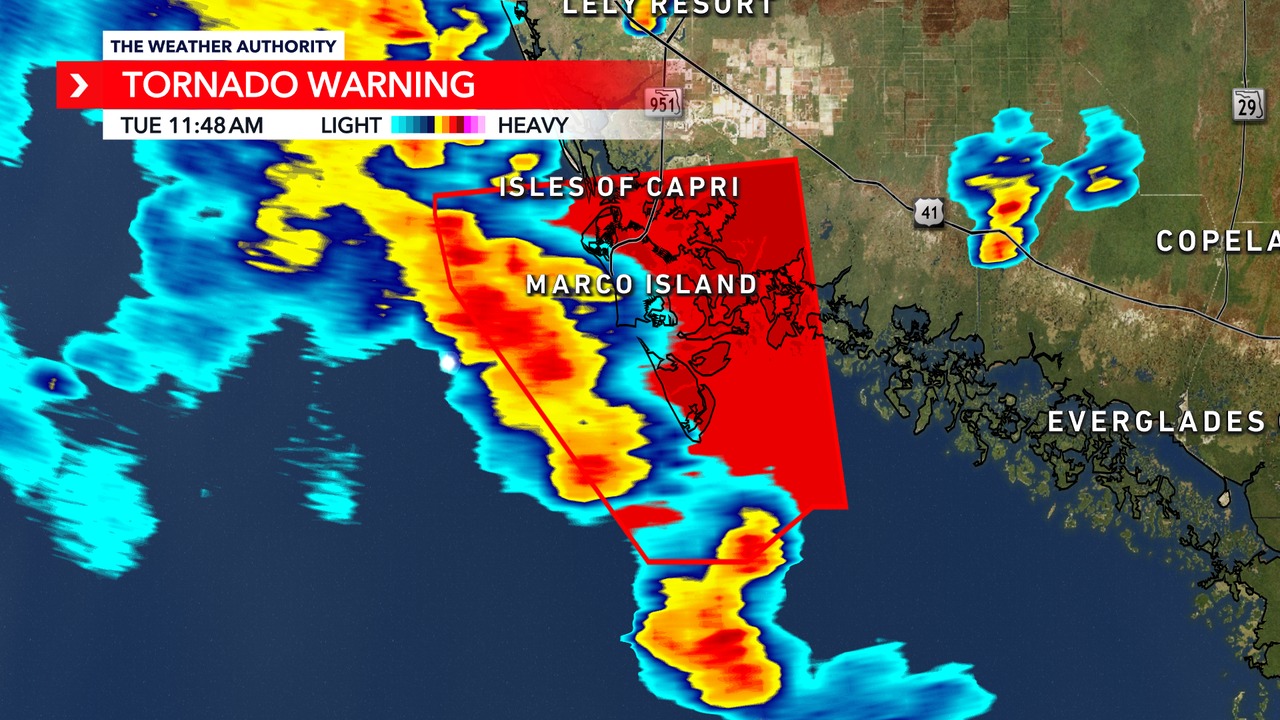
Tornado Warning Issued for Marco Island, Florida: What to Expect from the Incoming Storm

Milton, Florida — A tornado warning has just been issued for Marco Island as severe weather moves into the region. This follows the recent alert from meteorologists regarding the potential impacts of a major storm system affecting Florida, particularly areas such as Tampa and Orlando.

Understanding the Storm: A Closer Look
Meteorologist Brooks Garner from Fox 35 Orlando provided insights into the evolving situation. As the storm approaches, it’s essential to stay informed about its trajectory and potential impacts. Currently, the storm is nearing the Florida Keys, with an eye visible on the radar, signaling that it is getting closer to landfall.
Timing of the Impact
The storm is expected to make landfall around midnight on Wednesday, continuing into early Thursday morning. By the afternoon, it will likely exit the Atlantic coast, leaving behind significant weather changes. Heavy rainfall is forecasted across central Florida, particularly in Orlando, with the possibility of flooding reminiscent of Hurricane Ian’s devastation two years ago.
Current Storm Status
Initially classified as a Category 5 hurricane, the storm is projected to weaken to a Category 3 upon reaching the Gulf Coast. Despite this reduction in classification, it is crucial for residents to prepare adequately. According to Brooks, even as the storm weakens, it could still bring storm surges comparable to those of a Category 4 or 5 hurricane.
Major Concerns
- Storm Surge: Areas around Anna Maria Island and Bradenton are at risk of experiencing storm surges of up to 15 feet, especially in Manatee and Sarasota Counties. If the storm shifts its path, Tampa Bay could also be impacted severely.
- Rainfall: The storm’s rainbands may deliver over 4 inches of rain per hour, significantly increasing the risk of flooding from Tampa Bay up to Daytona Beach.
What Residents Should Do
With the unpredictable nature of hurricanes, it is imperative for those in evacuation zones to take the warnings seriously. Garner emphasized the importance of evacuation for anyone living near the coast, where the risk of storm surge is imminent.
Safety Tips
- Evacuate if Advised: If you live in an evacuation zone, prioritize your safety and evacuate.
- Stay Informed: Monitor local news and weather updates for the latest information on the storm’s path and impact.
- Prepare for Power Outages: As with many storms, power outages are likely, so have a plan in place for alternative power sources and supplies.
Conclusion
As Florida braces for the impacts of this major storm, residents are reminded that preparation is key. Although the storm is weakening, the potential for significant storm surge and heavy rainfall remains. Stay tuned to local meteorologists for real-time updates and guidance.
For those in the affected areas, remember: “Run from the water, hide from the wind.”


